Showing posts with label My travels. Show all posts

Saturday, July 7, 2012

Kending 墾丁and the National museum of marine biology 國立海洋生物博物館


I've been in Taiwan for almost three years now and although I've tried to be more active in my local travels lately, I've never made it to the famous beaches in the south of the island which are scattered around the small town called Kending (墾丁). In general, beaches in Taiwan are not what you would expect from a tropical island since Taiwan is an island of volcanic origin and the only  postcard-type beaches can be found in the south. 


I left Taipei on a sunny and humid Sunday morning. It wasn't 9 am yet and the temperature was already at 35 degrees. I took the High speed rail at the Taipei main station and after about 90 minutes arrived in Gaoxiong (高雄), which is the second largest city in Taiwan. From there I took a bus called the "Kending express" which after about an hour of a pretty sound ride arrived at the National museum of marine biology (國立海洋生物博物館), which is roughly 20 km away from Kending. 

The national museum consists of three large pavilions, an outside water park, research facilities and is absolutely amazing. The three pavilions are called: The Waters of Taiwan, Coral Kingdom and Waters of the world and for someone coming from a landlocked country like myself, they are absolutely fascinating.

Apart from buying a regular entrance ticket visitors have a 'sleepover' option, which is a two day-one night ticket with the possibility to sleep in the museum, and I went for that. By buying this ticket, visitors could choose to sleep in any of the three pavilions next to the exhibit of their choice. I chose to sleep next to the huge Whale shark fish tank and waking up with it swimming above my head was really something amazing. I think the shark must have been about 7 meters long and seeing such a huge animal swim right next to you as you wake up is truly unbelievable.

On the first day of our stay in the aquarium, we toured the 3 pavilions and the nearby coral beach with the aquarium staff. I learned a lot of fancy words like 鰓 (gills), 水母 (jellyfish), 鯨鯊 (whale shark) or 魟 (stingray), which I will probably only get to use when I go back to the aquarium next time:) 

We first went for a walk on the coral beach, looked for anything that moved and staff members explained to us what it was. Afterwards we toured the 3 pavilions, listened to lectures about everything possible from sharks to how the aquarium was built and did a lot of side activities like jellyfish feeding or going into the fish care area where daily guests were not allowed to go. Organization was wonderful throughout the whole stay and is a part of Taiwanese mentality that can only be admired. 


The next day morning I left the Aquarium and went further south to stay in a hotel not far from Nanwan (南灣), which is only one stop away from Kending and went straight to the beach. The water was warm like a bath tub and I never felt the sun burn so strong before in my life. At this time of the year, the weather in Taipei is changing fast. In the morning it is usually very hot and humid, with thunder showers in the afternoon. In Kending there are no thunderstorms, it is only very hot, very humid and a there is very strong sunshine throughout most of the day.


Small companies offering snorkeling services
Not far away from Nanwan, in Houbihu (後壁湖) I went to a small snorkeling beach. Although the coral reef was different from the ones that I've usually seen on TV, the diversity of fish life was stunning. I could recognize a lot of the fish that I saw earlier in the Marine museum. The snorkeling was a lot of fun, but it felt like being at a night market at times because of the amount of people there. 


Later that day I went to the southernmost point in Taiwan called Eluanbi (鵝鑾鼻) and the next day I took the bus back to Gaoxiong where I spent the rest of the day just wandering around the city until taking the High speed rail back to Taipei.
Taiwan's southernmost point
Directions and other information

Although there are other options, taking the High speed rail to Gaoxiong is the best one. If you order your ticket online 15 days before you go, you have a 30% 早鳥 (Early bird) discount.


As you get off the High speed rail in 左營 (the station for Gaoxiong), there is a small stand selling tickets for the Kending express bus. If you want to go to the Marine museum, get off at 保力 and wait for the connecting bus or take a cab, although cab prices are the double of what they are in Taipei.

Sunday, June 10, 2012

Hiking in Taiwan - Yangming Mountain biathlon

The Yangming Mountain National park (陽明山國家公園) is a wonderful place to go hiking with several hot springs, waterfalls, great views and most of all fresh air and the whole park is only a half an hour bus drive away from Taipei.

I went to the Yangming mountain (陽明山) several times but always took a bus from the ShiLin MRT station (士林捷運站) to the Yangming mountain tourist center and started the hike at the MiaoPu entrance (苗圃). I bought a bike last month and kept wondering whether there were any bike routes that would lead to the top of the mountain. As it turned out, there were none, because the last 2 km of paths are too steep to bike, but there are plenty of ways to get quite close. I searched the internet for some options and eventually decided to bike to LengShuiKeng (冷水坑), which is only 2.1 km away from the top of the mountain. 
牛奶湖 (Milk lake) at the Lengshuikeng tourist center


I started the whole trip near the ShiDa University (師範大學) at around noon and biked my way through crazy traffic all the way to ShiLin. At the ShiLin station I turned right and followed the route of the 260, 111 and 紅5 buses for about 1.5 km until I crossed a small bridge and got to the point which is labeled "A" on the map at the bottom of this article, which is where the bike climb started.  This road section is a 11.6 km long continuous climb, with an elevation of about 750 m and gets very demanding at some points. 

View of the East peak from the Qixing peak

My main concern was, that I might get lost on my way, because of the many intersections, but it turned out that the only thing I had to watch out for was not to miss a right turn at the traffic lights in a small town which was about 6.6 km away from point "A" (there is a 7 eleven on the right and something sort of like a bell tower that can be seen behind some trees across from the intersection. If I remember correctly, I followed the sign to 金山) and another left turn which was 1.2 km away from this intersection (the new road after the turn starts with a sharp ascent). From there, I just followed the road for another 3.8 km to the LengShuiKeng tourist center. 

Wonderful view of the 夢幻湖 from the 
It was about 35 degrees Celsius that day, very humid so my initial plan was just to bike to LengShuiKeng and go back to Taipei. It was a bit cooler at that altitude however and I didn't feel that tired so I decided to leave my bike at the tourist center and hike all the way up to the top of the mountain. 

A small look out point on my way up
The climb from the LengshuiKeng side is 2.1 km long with an elevation of about 370 m. As I was going up the mountain it was getting cooler and cooler (at the top of the mountain it was only 18 degrees Celsius), winds started to pick up, the views were amazing and at that temperature the YangMing Mountain snakes were not that active either:) Since I left my bike at the tourist center which would close at 4:30 pm, I had to be back by then and did the whole hike in less than an hour. 

The bike way back down the mountain was a lot of fun. There were a lot of cars on the roads because it was a weekday and my forearms hurt from all the braking, but all in all it was great.

Additional Information:

Name: 陽明山 (Yangming mountain), 冷水坑 (LengShuiKeng), 七星山 (QiXing Peak)
Location: Taipei county
Elevation: 1120 m

Bike section: 11.6 Km, Elevation 750 m (from "A" (仰德大道一段/台2甲線 intersection) to "B" (冷水坑)
Hike section: 2.1 Km, Elevation 370 m (from 冷水坑 to 七星山)


Directions and other information:

It depends on where you live in Taipei, but I think the most general directions and the best way of how not to get lost is to get to the ShiLin MRT station and start from there.

If you can, take a lot of water or energy drinks like 舒跑 with you. I didn't know how many 7 elevens there would be on the way so I took 4 liters of water and 舒跑 with me. The climb was really hard at times and all this water was a lot of extra weight, so a better idea might be to buy water as you go. 

View of the LengShuiKeng tourist center
Another good thing to do is to start eating a lot of carbohydrates from sources like wholegrain bread, pasta or potatoes the day before you start your trip to store up some extra glycogen in your body and eat 4-5 bananas during your trip. My entire biking route was 46 km long and took me almost 3 hours to complete and I think I couldn't have done it without this sort of carbohydrate loading the day before. 


Sunday, September 25, 2011

Hiking in Slovakia – High Tatras

Waterfalls, mountain lakes, mountain streams, amazing views and weather
I went back to Slovakia during the summer and after a very very long time visited the High Tatras. My log is mostly about languages and I know that posts about climbing mountains or river tracing might not be interesting to all of the readers, but this trip was so amazing, that I decided to at least share some of the pictures we took. My highschool friend bought a flat in Tatranska Strba, only a couple of stations of rack railway away from Strbske pleso (the main tourist hub), so we decided to go there on Friday evening and start the trip on Staurday morning. 


High Tatras are amazing in any weather and any season, but that Sarurday there were almost no clouds in the sky and the temperature was around 25 degrees, making the conditions very suitable for a good hike. When we arrived at Strbske pleso, we decided to take the yellow route to the Furkotsky peak, which had a lot of interesting sights on the way. The entire hike was about 22 km long, but was definitely worth the effort.

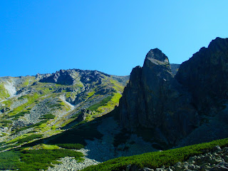
Some views of the Tatras from Strbske pleso:


Pictures from our way up:


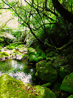
We came across this nice stream on our way to the waterfall:


The Skok waterfall:

Looking down from the waterfall at mid-level:


Actually, our original plan from the day before was just to go and see this waterfall, but the view of the mountains behind was really amazing (unfortunately can't be seen in this picture) so we decided to go on. As we climbed up the side of the waterfall this was the view we got:


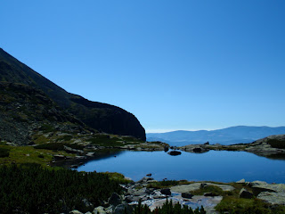
We turned around and hiked for about an hour and a half further up the mountain. The road was quite difficult to walk on, because it was mostly made of 50cm X 50cm X 50cm strangely shaped rocks. We arrived at a small summit at a mountain lake called Capovo pleso:


An interesting thing that happened here was that out of nowhere there was this nude man swimming in the lake. The lake is a national reserve protected by the government so some of the tourists were quite  outraged by this, but well.. we just had a good laugh and went on :)


The above pictures are all pictures of Capovo pleso taken as we were hiking up towards the Furkotsky peak which is at 2 403 meters above sea level. The hike quickly turned into a semi-climb and at places was quite dangerous. We met an unfortunate Hungarian elderly gentleman who was tired, had pulled his muscle, couldn't relax it and was unable climb back down. He said the other side of the mountain was quite difficult to descend down on too so in the end we decided not to climb the peak itself and pass through the 'saddleback' of the mountain on to the other side instead. 

Nice views from the saddleback (Upper Wahlenberg mountain lake in the picture):


Resting at the saddle back, I was thinking for a moment, that some big rock might loosen and hit my head, but they all seemed to be in place for quite some time so I hoped that they'd remain that way. Picture of the peak directly above the saddleback:


Climbing back down the other side of the mountain, I was starting to get a bit tired. I was just waling and talking and didn't pay much attention to the surrounding environment which was a shame, because I could've taken more pictures like this one:


After 22 km we came home exhausted. It was truly an amazing and refreshing trip. After we packed our things, we still had some time to appreciate this wonderful sunset:


Additional information:

Name:  Vysoké Tatry - Furkotský štít (High Tatras - Furkotsky peak)
Location: High Tatras, Slovakia
Elevation: 2 403 m

Directions:

To be honest, I am not really sure how one should get there by train, because we went there by car. I think you should take a train to Poprad or Tatranska Strba and from there take the rack railway to Strbske pleso. If you drive a car, you can drive all the way to the Fis Hotel's parking lot which is to my knowledge the closest you can get to the waterfall in a car. Either way, if you are Slovak, you probably know how to get there and if you are a foreigner, you will probably go there with Slovaks who will know the directions:)

Misc:

After hiking in Taiwan at 35 degree temperatures and crazy humidity, I had to wear a sweater hiking this mountain and didn't have to drink a lot of water. To have good water supplies is good idea though and what you definitely do need to have are good shoes and sun protection. 

Wednesday, June 8, 2011

Hiking in Taiwan - 陽明山 (Yangming mountain)

I went to Yangming mountain last week but took no camera and was later pretty sad, because there were some nice things worth taking pictures of. Since the place is not that far from Taipei city, I decided to go there again, just to take some pictures and try a different route.

陽明山 (Yangming mountain) is acutally a complex of hills and peaks with the main peak called Qixing peak which is 1120 m above the sea level and the view from it is quite nice. It took me around an hour to get from the Yangming mountain station tourist center to the top, but I was taking pictures and resting so I think it could be done in 30-40 minutes of active walking.

The last time I went there I started at the Miaopu entrance, hiked all the way up to the Qixing peak and went down the other side to Xiaoyoukeng  and then took the bus back to the Yangming mountain terminal station. This time I started at the same place, but then went to Lengshuikeng, because I heard there’s nice waterfall there. The waterfall was nice, but unfortunately tehre was a fence and signs saying that it was dangerous to approach it. Being as hot as it was, that waterfall could’ve made my day. The waterfall started a nice little stream which eventually turned into a river. The hiking trails were always far up high from the stream, so it seemed impossible to get closer to it at first,  but I managed to find a small entrance, got off the hiking trail and made my way through the jungle directly to the river. I was so sad that I didn’t have river tracing shoes, because I would’ve traced the stream right back to the waterfall. On the other hand, I was alone and pretty far from the hiking trail, the rocks were slippery so I think it’s a better idea to go there next time.

The route:  

I started off at the Miaopu entrance at around 11 am. The heat was already pretty intense and the humidity was high as always, which I personally enjoy very much. The trail first goes along a freeway and then turns left into the jungle and was turning steeper every 200-300 meters or so:


After I passed  a certain height, the vegetation around me changed to low, sharp-leaved bamboo. It also got much cooler:


View of the QIxing peak:


Qixing peak:
 

Again there were hundreds of butterflies everywhere. There was this very nice big black/blue one that I wanted to take a picture of, but it always flew away or had it's wings closed. I was taking pictures until I finally got a nice one while he was flying:

Some views from the Qixing peak:  


The wind was quite strong at the top. After a little rest I made my way down the south side of the mountain to Lengshui keng to look for the waterfall. 

After coming to Lengshui keng, at the tourist center I asked for directions for the waterfall. Maybe I was lucky, because there were no clear signs directing hikers to it, but I eventually found it. There were other very inspiring signs though:


I made my way through the trails. Along them a small stream started to build up that grew larger and larger, eventually I could hear the waterfall from a distance. When I arrived I was quite disappointed, because I couldn't go all the way to it, because of a fence and warning signs.


At the bottom of the waterfall a small river was starting to build up:


The stream slowly started to turn into a small river and as I said, I managed to get into it, even though it seemed impossible at first. I would definitely like to trace this river from the other end all the way to the waterfall. See how that goes:


Additional information:

Name: 陽明山 (Yangming mountain)
Location: Taipei county
Elevation: 1120 m

Directions:
Take the MRT to Shilin station and from there, if on a weekend, take the 111 bus right at the Shilin station, or on a weekday, turn right and walk to the McDonalds and take either 260 or 紅5. The 111 is better because it will take you all the way to the tourist center near the Miaopu entrance, the other two buses will take you to the Yangming mountain terminal station and you will have to walk for about 20 minutes to get to the Miaopu entrance.

Misc:
If you go in summer, take a lot of water. good shoes are preferable, although I've seen barefoot people again. I would rate the hike to be a solid 2 on a 0-5 scale, but again, only if it's really hot and humid.